


Voting District 10285, Kern County, California
About
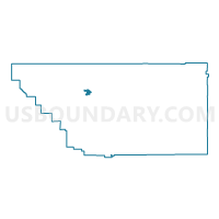
Outline

Summary
| Unique Area Identifier | 531355 |
| Name | Voting District 10285 |
| County | Kern County |
| State | California |
| Area (square miles) | 9.34 |
| Land Area (square miles) | 9.34 |
| Water Area (square miles) | 0.00 |
| % of Land Area | 100.00 |
| % of Water Area | 0.00 |
| Latitude of the Internal Point | 35.48815800 |
| Longtitude of the Internal Point | -119.19363780 |
Maps


Graphs
Select a template below for downloading or customizing gragh for Voting District 10285, Kern County, California


Neighbors
Neighoring Voting District (by Name) Neighboring Voting District on the Map
- Voting District 10115, Kern County, CA
- Voting District 10130, Kern County, CA
- Voting District 10155, Kern County, CA
- Voting District 10260, Kern County, CA
- Voting District 10265, Kern County, CA
- Voting District 10290, Kern County, CA
- Voting District 10295, Kern County, CA
- Voting District 10300, Kern County, CA
- Voting District 10305, Kern County, CA
- Voting District 10310, Kern County, CA
- Voting District 10375, Kern County, CA
- Voting District 10390, Kern County, CA
- Voting District 10391, Kern County, CA
- Voting District 10400, Kern County, CA
Top 10 Neighboring County Subdivision (by Population) Neighboring County Subdivision on the Map
Top 10 Neighboring Place (by Population) Neighboring Place on the Map
Top 10 Neighboring Elementary School District (by Population) Neighboring Elementary School District on the Map
- Richland-Lerdo Union Elementary School District, CA (19,085)
- Rio Bravo-Greeley Union Elementary School District, CA (4,787)